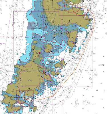
With the weather looking reasonable from Tuesday or Wednesday I planned another couple of short legs, the first is a very small anchorage with excellent protection from any swell or waves coming in from the Atlantic, there is little protection from the wind but that is likely to be around Force 3 so is a non issue.
Threads
Sunday, May 28, 2023
Saturday, May 27, 2023
2023 May 25, Days 41 - 43 to Loch Keivagh and Lochmaddy.
My plan was to spend the night at Loch Keivagh then Friday and Saturday nights at Loch Maddy either both in the marina or one there and one at anchor depending on exactly when some strong winds went through.
.JPG) |
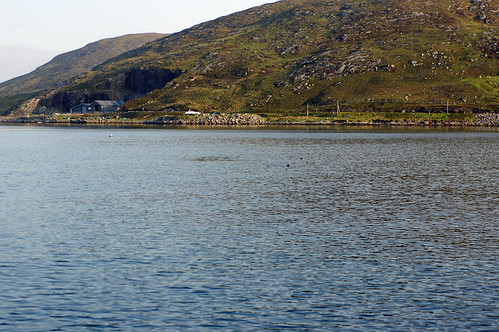
| Entering Loch Keivagh |
 |
| My track in and out of Loch Keivagh. Not shown on the chart is a large fish farm east of the green starboard hand lateral mark, it is shown on the Admiralty chart. |
Lochmaddy
I'm likely to be there for 3 nights as F4-6 winds are forecast for the Minch (F7 in the north) but looking OK for next week with seas < 1 metre by Wednesday for several days but NE winds on Thursday could mean a long trip back to the Sound of Harris.
Apart from the overturned section and obvious issues with the section opposite it, the whole spine has been moved at least 20' right (check the kink from the ramp) the resident commercial boats (left) where unable to operate for some time, as of November it is not known when it will reopen for visitors but hopefully before next sailing season.
The Ferry docking.
22 miles in three and a half hours.
2023 May 24, Day 40 To the Wizard Pool, Loch Skipport.
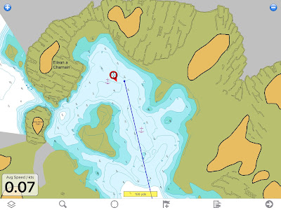
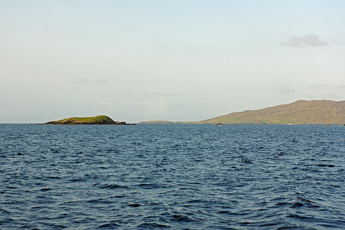
The best spot was taken by a boat staying all night so I chose to anchor between Wizard Island and a rock that uncovers almost to windward.
.JPG) |
| This boat was in position "A" in these conditions. |
 |
| The Wizard Pool, position A in the given wind was in the NW corner but I had to settle for where the red circle is with the anchor towards the small rock. Note the scale. |
In my view this anchorage is much better than the next door Kettle Pool that I used last year, except probably in a north easterly.
.JPG) |
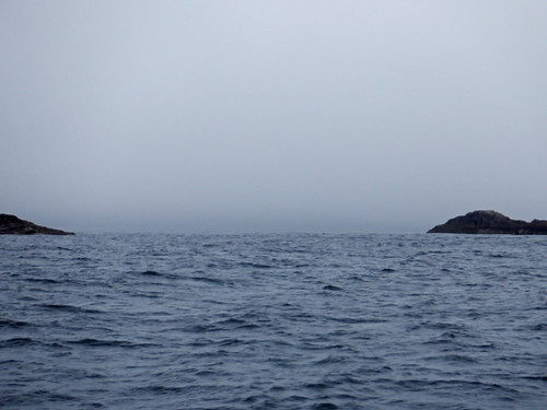
| The channel to Kettle Pool. |
 |
| My track going out, the initial move west is largely hauling the anchor up. |
15 miles in 4 hours
Tuesday, May 23, 2023
2023 May 22nd, Days 38 & 39 CastleBay to Lochboisdale.
I had planned to go into the Sound of Barra for a look round but the wind was a very cold force 4 - 5, I was wearing gloves for the trip despite bright sunshine, so I decided not to and by lunchtime I was in Lochboisdale marina which is well sheltered and hopefully would have hot water in the showers - they did.
Back in 1978 whilst sailing on the half tonner "Green Dragon" we and another boat hit what is believed to have been a Basking Shark off Portland Bill, just past the Sound of Barra I almost did it again; I was sailing so not making much noise and it was fully underwater so I could not see it; then a big tail briefly appeared close off of the port bow and then all that was to be seen were a lot of swirls in the water as long as the boat only 4 or 5 yards away.
 |
| Entering Loch Boisdale. |
There is no grocery shopping here and the only shopping point on route is at Loch Maddy and that is very limited so it looks like I will be on tinned food for a while from later in the week.
 |
| I rather like this warning sign on the causeway road. |
21 miles in 6 hours.
2023 May 21st, Day 37 Cornaig Bay to Castlebay.
After days with little or no internet access I have found that "marine traffic's" ground stations lost contact with me half way to Vatersay, I have manually updated my position today and will do so in the future IF I can get an internet connect.. Providing I remember to switch on the IridiumGo, tracking without paying for Marine traffic's satellite tracking service should be available from "Track Sancerre" above.
.JPG) |
| A lovely morning made a nice change and as I was only moving a short distance the lack of wind did not bother me. |
A small cruise ship arrived early on Sunday putting a number of tourist ashore then got them back and set sail at lunch time as everything opened up. As least they, including the Coop opened in the afternoon, they don't everywhere in the Western Isles.
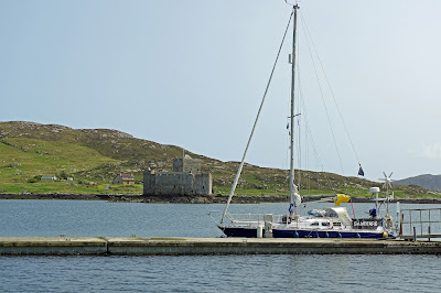 |
| Why its called Castlebay, the castle is on an Island. |
Sunday, May 21, 2023
2023 May 20th, Day 36 Vatersay Bay to Cornaig Bay
I was fog bound with visibility less than 150 metres and no phone signal on O2 or Vodaphone so the only forecasts I had were the downloads via satellite for wind, rain and pressure and a general warning on the slightly out of date shipping forecast of some fog banks in the Hebrides.
I could see that I needed to be in shelter by Tuesday evening because of strong westerly winds, I would be OK at Vatersay Bay and a couple of other places but did not want to stay here that long especially if the weather was poor, so I called my wife on the IridiumGo satellite app only to find there was no mention of fog in the domestic forecast for Barra Airport just up the coast. So I would just have to wait and see.
The fog lifted to give about a mile visibility so I moved north through the Fisherman’s Passage with the option of going to CastleBay or an anchorage at Cornaig Bay on the north shor of Vatersay.
The Fisherman’s Passage is only 35 yards wide although from a distance it looks much wider as many of the bounding rocks are underwater or awash. Passing through was a bit of a white knuckle ride as it looked far narrower due to a lot of floating seaweed on the channel side of the partially submerged central rock and the islet to the east.
Approaching the narrow part of Fisherman's Passage between Vatersay and Muldoanich. Note the rock just awash near the middle of what appears to be the passage (at the end it is almost in line with the main shroud, full screen may be needed to see it).
.JPG) |
| The rock mentioned when it came abeam. |
I had plotted the route on the Memorymap iPad App using the highly detailed Antares charts that are aligned with gps, transferred that into the Garmin iPad App which automatically loaded it into the plotter. I then went through on autopilot monitoring my position and Xtrack error on two independent GPS / charting systems, one raster (Antares) and one vector and by Mk I eyeball.
When single handed you want to avoid as many distractions as possible and manual steering in a narrow channel with tide is a big distraction.
I was hoping to get a phone signal from a mile off of the village of Castlebay which is a ferry port and the main settlement in the southern Outer Hebrides and could then decide what to do. No such luck, no phone signal, and Castlebay anchorage and pontoons are exposed to the SW wind, only F3 – F4 at the time but could get stronger and whilst I could do with a shower and a bit of shopping I opted for comfort and headed for Coraig Bay where, by late afternoon I was again fog bound.
%20pan.jpg) |
| The bay next morning. |
The current plan (Saturday evening) is to go into Castlebay on Sunday when the wind is due to be northerly, briefly explore and anchor in The Sound of Barra on Monday and head for Loch Boisdale, S. Uist on Tuesday for a night or two until the strong-ish winds have passed through on Wednesday or Thursday, there is no worthwhile grocery shipping there but showers, laundry and a hotel which served some decent fish and chips when I was there last year.
Four Miles in an hour and a quarter.2023 May 19th, Day 35 Loch Drumbuie to Vatersay Bay.
The 20:30 download on Thursday showed reasonable conditions on Friday but on some models possibly iffy on Saturday with winds favourable in the morning but not so good in the afternoon with the possibility of higher waves due to strong winds further out in the Atlantic so Friday it was, and an 04:00 start to avoid adverse tides getting out of the Sound of Mull and past Ardnamurchan point. That meant an 03:15 alarm as my back is still playing up and I need half an hour after getting up before it eases and I can do anything useful.
I was away at 04:10 and was sailing in light winds shortly after getting out of the Loch but it was short lived and the engine went back on for short periods twice to get clear of the point and then I was sailing in a fairly steady 8 knots of wind from the WSW.
Bad new came at about 05:30 when I found my main domestic battery bank (2 x 120 Amp Hour AGM's) was indicating only 65% charged, although later that was found to be rather pessimistic, I had a problem; especially as it was discharging at over 5 amps, more than I would expect even with low input from the solar and virtually none from the wind turbine. I switched off non essentials like the cool box and it was still going down, I started the engine and no charge!
Not an emergency as I have a separate engine battery and a third 120 amp AGM domestic battery and can start the engine from any or all of the three “banks” but concerning, and if it was the alternator I would have to go direct to “civilisation” with good communications so I could get a replacement shipped there.
 |
| Alternator top right, water pump bottom left. |
The engine started and thanks to the external “intelligent” regulator the 55 amp alternator was soon charging at over 40 amps to the domestic batteries with more to the engine (I don’t have an ammeter on that) and keeping the boats electrical systems working.
I don’t know when the wire broke, both domestic banks were at 100% the previous evening but with some sunshine, a rare commodity, and some wind the “renewables” could have made good usage from a failure any time after Tobermory.
The main domestic bank recovered quickly, I think it had gone down to between 70 and 75%, still a lot on 240 Amp Hours, part of this and the high discharge rate I spotted, was down to it discharging to the engine battery; because the engine had been running (ignition on) the Digital Voltage Sensitive Relay was enabled and that allowed current to flow - unlike some more expensive types it is bidirectional. I had started the engine half a dozen times and the alternator was not recharging, then there was getting the anchor up. I motor sailed for an hour or so to get charge back into the batteries and then it was back to sailing.
The sailing was cold and damp with mist patches and occasional drizzle but on the bright side the steady rain did not appear until after I had got to Vatersay Bay.
And the wildlife spotted on this leg was exceptional, not much variety in birdlife just the ubiquitous Guillemots and a few Gulls and Gannets but the marine life was like nothing I have seen before in just a few hours:
- 200+ Dolphins north of Hawes Bank (which is north west of Coll, see chart above) over many square miles, visible for well over an hour mainly as I moved west at 5.5 knots (motor sailing after the alternator problem).
- Multiple small pods of Dolphin all the way over.
- 3 individual Minke Whales - off Hawes Bank, ½ way over and a couple of hours out.
- A small(?) pod of Orcas @ 12:30 c 12 nm SW of Hyskeir Rock. c 56º 50’ N 6º 57’ W
- A basking shark ½ mile SE of Muloanich (which is just E of Vatersay).
.JPG) |
| A distant pic of the Basking Shark, it takes time to get the camera up and running! |
 |
| The famous beach at Vatersay Bay, reckoned to be the finest in the Western Isles. |
.JPG) |
| Not looking its best in the mist but at least by then I could see to the end of the bay. |
58 miles in 14.5 hours.
Click here for the short leg through Fisherman's Passage to Cornaig Bay.
2023 May 18th, Day 34 Tobermory to Loch Drumbuie
Friday or Saturday looked as if they might be OK to get across to the Western Isles so rather than pay another nights mooring I moved to Loch Drumbuie, a short hope to the NE.
According to the pilot this is a very popular and often crowded anchorage, probably because its free! And indeed its quite attractive and well sheltered but most is very deep so boats cluster in a few sheltered spots so I can see how it gets crowded.
I was the first arrival but what looked like an “Open 60” single or 2 handed handed racing boat converted to cruising with a crew was close behind also coming from Tobermory and a third followed later, a familiar boat but I can't place where I have seen it previously, it could have been on a previous trip or the day before. This happens a lot, serious cruisers bump into each other, hopefully not literally, quite a lot, for instance on a Pontoon at Tobermory was a boat last seen at Newlyn and it would not surprise me to see them again as they are up here for the summer.
Update: I did - at Tobermory on the way back, then they arrived in Newlyn 20 minutes before I left and I later heard them talking to the Coast Guard giving information on another's Pan Pan.
 |
Five miles in an hour and a quarter.
Wednesday, May 17, 2023
2023 May 16th, Days 32 - 33 Loch Aline to Tobermory.
Although it is unlikely that I can get across to the Outer Hebrides until Friday or Saturday there is a chance and I wanted a shower, diesel (cheaper than at home), Camping Gaz (£45 !!!) and some other things so I decided to move to Tobermory.
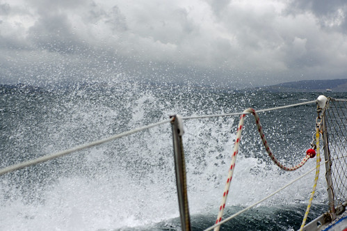
It was a very bumpy ride for the first half of the trip, the very benign conditions in Loch Aline changing to 17 - 20 knots of wind against 1 - 2 knots of tide.
14 miles in two and three-quarter hours, all under engine.
Sunday, May 14, 2023
2023 May 14th, Day 30 Scallastle Bay to Loch Aline
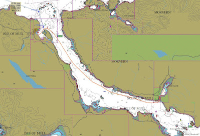
The forecast indicated that there would be no reasonable chance of getting to the Outer Hebrides any time soon and with NW winds forecast I decided to move to an anchorage with more protection for a couple of nights before moving to Tobermory for laundry and resupply. Loch Aline was the perfect place and close by which was useful as my back was (and still is) playing me up and I did not want to do anything to make it worse.
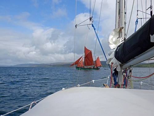
"Provident" a fine old gaffer beating up the Sound of MullBest to turn off the sound, just lots of wind noise.
Entering Loch Aline through the narrow channel andsometimes very busy entrance.
2023 May 13th, Day 29 Loch Tarbert to Scallastle Bay, Sound of Mull
A disappointing day although not surprising given the previous evenings forecast. There was a nice breeze when I left but it disappeared after half an hour and I motored the rest of the way initially heading for Lock Spelve which has an anchorage suitable for the forecast fresh winds. However, as I approached it became clear that there was an event taking place with a dozen vessels entering before I got there and quite a few more heading that way.
With a still SW wind forecast for that night I decided on an anchorage on the west side of the Sound of Mull and chose Scallastle Bay, about four miles from Duart Point which I reached shortly after the tide turned foul.
.JPG) |
| Fairly miserable weather to start but from late morning it was largely sunny and warm. |
 |
| Another three boats going into Loch Spelve. |
 |
| It felt like the Solent as I rounded Duart Point with three Ferrys in view, these two heading for Oban passing south of Lismore Island. |
.JPG) |
| Duart Castle, Mull. |
.JPG) |
| The view from the anchorage across the entrance to the Sound of Mull to Lismore and the mainland north of Oban. |
41 miles in 7.5 hours.
.JPG)
.JPG)
.JPG)
.JPG)


.JPG)


.JPG)
.JPG)


.JPG)

.JPG)
.JPG)
.JPG)

